Elevation Certificates in Florida
Tailored to address flood compliance and planning needs, Atlantic Coast Surveying specializes in providing Elevation Certificates across Florida. Prepared by our licensed surveyors, these essential documents certify your property’s elevation relative to the base flood elevation (BFE). They play a critical role in flood risk assessment, insurance requirements, and development planning.
Precision You Can Trust in Elevation Certificates
When it comes to Elevation Certificates, Atlantic Coast Surveying sets the standard for accuracy and reliability. Our licensed surveyors specialize in certifying property elevations relative to the base flood elevation (BFE), helping clients address flood compliance, insurance, and construction planning needs with confidence.
With over 35 years of experience and cutting-edge surveying technology, we ensure every document meets FEMA requirements and is prepared with the utmost attention to detail. Whether you're managing flood zone discrepancies, applying for FEMA LOMA or LOMR letters, or planning a development project, you can trust us to provide the precise data you need to make informed decisions every step of the way.
Understanding Your Challenges
Navigating flood compliance, insurance requirements, and construction planning demands precise elevation data. Without accurate and certified documentation, property owners and developers face challenges like costly flood insurance premiums, project delays, or unforeseen complications in meeting regulatory standards. Whether mitigating flood risks, ensuring compliance, or planning safe developments, precise elevation data is essential. That’s why Atlantic Coast Surveying provides Elevation Certificates to eliminate uncertainty, ensuring clarity and confidence for your projects.
Elevation Certificates - The Solution
An Elevation Certificate is a formal document prepared by licensed surveyors to certify a property’s elevation relative to the base flood elevation (BFE). These certificates are critical for flood insurance assessments, FEMA requirements, and floodplain management. Using our unmatched expertise and advanced technology, we deliver reliable, certified documentation that supports compliance and planning efforts.
Key Features and Benefits
- Flood Compliance: Ensures your property meets FEMA and local regulations, avoiding non-compliance issues and supporting successful project approvals.
- Insurance Savings: Provides proof of accurate elevation data to help reduce flood insurance costs by reflecting the true risk level.
- Unmatched Precision: Certified by experienced professionals using cutting-edge tools to guarantee highly reliable and accurate measurements.
- Expertise You Can Trust: Backed by over 35 years of industry experience, ensuring dependable and professional results for property owners and developers.
- Custom-Tailored Solutions: Each Elevation Certificate is customized to address your property’s unique requirements, equipping you with actionable insights for confident decisions.
FEMA Letter of Map Amendment (LOMA)
At Atlantic Coast Surveying, our FEMA LOMA (Letter of Map Amendment) services aid property owners in resolving flood zone disputes and potentially reducing flood insurance costs. While an Elevation Certificate provides the essential data about your property’s elevation, a LOMA is the official FEMA document to reclassify your property’s flood zone.
Our FEMA LOMA services include:
- Elevation Certification: Precise elevation data to support flood zone reclassification.
- Flood Map Analysis: Identification of errors or discrepancies on FEMA flood maps.
- Streamlined Application Process: Preparation and submission of all necessary documentation with expert guidance.
These services are essential for addressing flood zone misclassifications, minimizing insurance costs, and ensuring peace of mind. Trust Atlantic Coast Surveying for reliable expertise and accurate results tailored to your needs.
LOMR (Letter of Map Revision)
At Atlantic Coast Surveying, our LOMR (Letter of Map Revision) services offer precise solutions for property owners seeking to amend FEMA flood hazard maps. Through comprehensive analysis and expert documentation, we help redefine flood zones to support accurate insurance requirements and safe development planning.
Our LOMR Services include:
- Flood Zone Analysis: Thoroughly reviewing current flood hazard maps to pinpoint inaccuracies affecting your property.
- Elevation Verification: Providing accurate elevation data to justify map revisions and support FEMA approval.
- Hydrology and Hydraulic Studies: Conducting detailed assessments of water flow patterns to ensure reliable flood zone mapping.
- Regulatory Compliance Support: Ensuring your map revision aligns with FEMA’s standards and local guidelines.
These services are indispensable for property owners addressing flood zone challenges or redefining flood risks to facilitate compliant development. Count on Atlantic Coast Surveying for accurate data, professional insights, and tailored guidance for your LOMR needs.
Precision in Every Measure
Who Benefits from Elevation Certificates?
Discover how Elevation Certificates provide essential documentation and reliable elevation data tailored to meet the needs of professionals and industries ensuring flood compliance, reducing insurance costs, and supporting safe project planning.
Real Estate Professionals
Streamline property transactions with certified elevation data that clarifies flood zone classification and supports informed decisions.
Construction Companies
Enhance project planning and execution with elevation data that ensures compliance with flood regulations and supports efficient construction processes.
Legal Professionals
Rely on trusted elevation documentation to address flood-related property disputes, ensuring accurate data for legal cases.
Lenders and Title Companies
Secure elevation certifications to verify flood risk and property details, confidently supporting funding and title processes.
Government Agencies
Maintain compliance and accuracy in public infrastructure and community planning projects with certified elevation data.
Environmental Consultants
Facilitate sustainable development by aligning projects with environmental regulations using reliable elevation information.
Engineers and Architects
Develop innovative, flood-compliant designs with precise elevation data integrated into overall project plans.
Insurance Providers
Accurately assess flood risk and determine fair coverage solutions based on FEMA-compliant elevation documentation.
Precision in Every Step
Elevation Certificate Process
At Atlantic Coast Surveying, we take a thorough and transparent approach to preparing Elevation Certificates. Our streamlined process ensures precision, compliance, and clarity for your projects, addressing all relevant FEMA and regulatory requirements to support flood compliance and construction planning.
Initial Consultation
We begin with a detailed consultation to understand the specifics of your property and project needs. Whether your Elevation Certificate is required for flood insurance assessments, compliance with FEMA regulations, or construction planning, we tailor our approach to simplify the process and meet your objectives.
Site Evaluation and Scope Definition
Our team carefully reviews your property’s details, defining key data points such as elevation levels and flood zone boundaries. This step ensures we capture the critical information necessary for producing accurate and reliable Elevation Certificates.
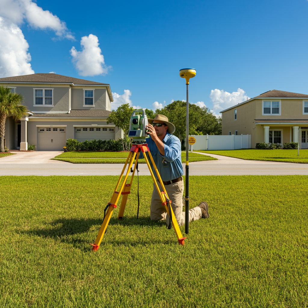
Data Collection
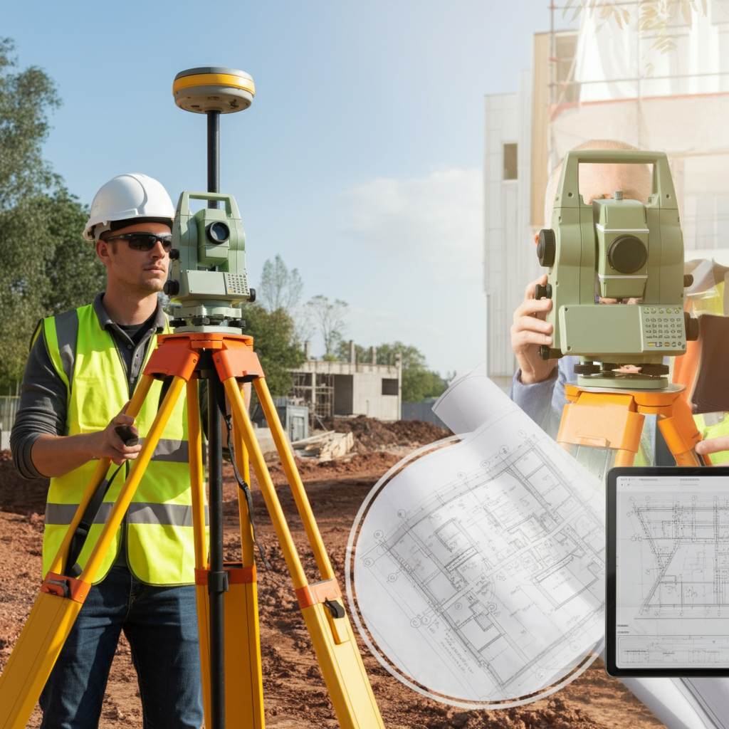
Using advanced surveying equipment such as GPS devices and precision leveling tools, we gather precise elevation data. We document all necessary details, ensuring compliance with FEMA standards and producing measurements of the highest accuracy.
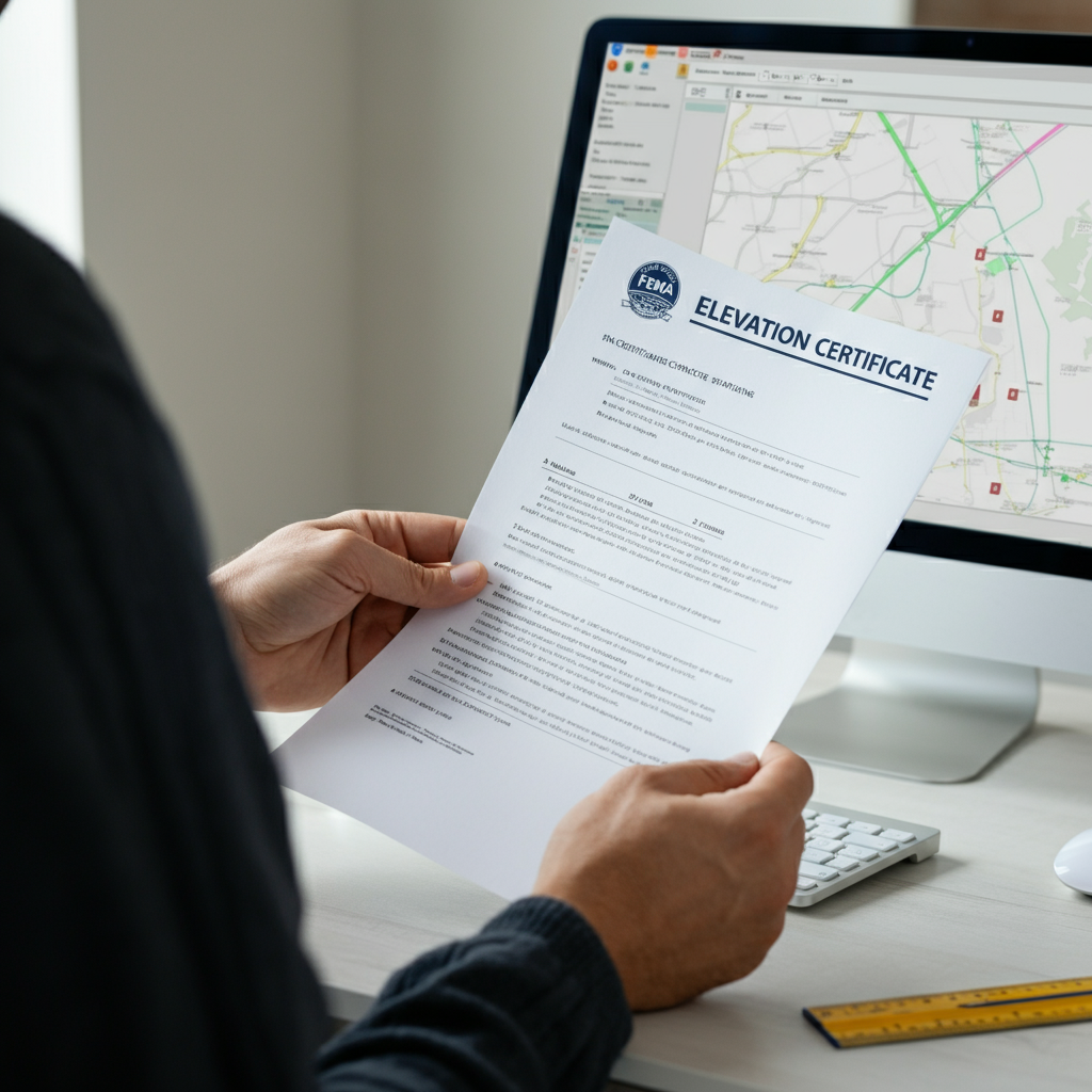
Analysis and Reporting
Once the data collection is complete, we analyze the findings and compile them into a comprehensive Elevation Certificate. Each document is clearly presented, easy to understand, and designed to support your decision-making while adhering to all relevant FEMA and industry standards.
Frequently Asked Questions
Everything You Need to Know About Elevation Certificates
Get clear answers to common questions about Elevation Certificates. Understand how they provide precise elevation data, why they are essential for flood compliance and insurance purposes, and how they support construction planning with accuracy and reliability.
What is an Elevation Certificate and why do I need one?
An Elevation Certificate is an official document prepared by licensed surveyors. It details specific elevation data for a property relative to the base flood elevation (BFE). You need one to determine your property’s flood risk, comply with FEMA regulations, secure accurate flood insurance rates, and assist in construction planning in flood-prone areas.
How can an Elevation Certificate help lower my flood insurance premiums?
Insurance providers use Elevation Certificates to assess flood risk. If your property is found to be above the base flood elevation, this can indicate lower risk, leading to reduced flood insurance premiums. However, insurance rates depend on your provider’s assessment policies.
Who is required to get an Elevation Certificate?
FEMA Flood MapProperty owners within designated flood zones often need an Elevation Certificate to comply with FEMA and local regulations. It is also commonly required by lenders, insurance providers, or potential buyers during property transactions. Additionally, developers may need one for flood-compliant construction projects.
How do I determine if my property needs an Elevation Certificate?
If your property is located in or near a designated flood zone (as identified on FEMA maps), you may need an Elevation Certificate. If you’re unsure about your property’s flood status, contact our team at Atlantic Coast Surveying for guidance.
How long does it take to get an Elevation Certificate?
The process typically takes a few days to a week, depending on factors such as the size and location of your property. After conducting a site evaluation, we analyze the data and prepare the certificate promptly to meet your needs.
What information is included in an Elevation Certificate?
An Elevation Certificate includes critical details such as the property's location, flood zone designation, elevation of the building's floors, and base flood elevation. This data is essential for assessing flood risk and meeting compliance standards.
How much does an Elevation Certificate cost?
The cost of an Elevation Certificate depends on factors like the property’s size, location, and complexity. For an accurate quote, reach out to Atlantic Coast Surveying, and our experts will provide a tailored estimate.
Can I use an older Elevation Certificate, or do I need a new one?
If your property’s flood zone status, structure, or surrounding conditions have changed, you may need a new Elevation Certificate. It’s always advisable to check with your insurance provider or local officials to ensure that your documentation is up-to-date.
Do I need an Elevation Certificate if my property is not in a flood zone?
FEMA Flood MapWhile it’s not usually required for properties outside flood zones, obtaining an Elevation Certificate can still be beneficial. It helps confirm your property’s status, provides assurance for future transactions, and may even reduce your flood insurance costs if you’re mistakenly classified as at risk. To check if your property is in a flood zone, visit the FEMA Map Service Center at https://msc.fema.gov/portal/home.
How is the data for an Elevation Certificate collected?
Our licensed surveyors use advanced tools, such as GPS devices and precision leveling equipment, to gather accurate data. We ensure compliance with FEMA standards and record all necessary details to provide a reliable Elevation Certificate you can trust.
Your Trusted Surveying Partner
Why Work with Atlantic Coast Surveying?
When you choose Atlantic Coast Surveying, you’re partnering with a team committed to delivering excellence. Here’s what sets us apart:
Licensed and Insured Professionals
Our skilled surveyors bring unmatched expertise and meticulous attention to detail, ensuring every project is completed to the highest standards.
Advanced Technology for Superior Accuracy
Leveraging state-of-the-art tools like GPS systems and 3D scanning, we provide precise and efficient surveying solutions tailored to your project's needs.
Customer-First Approach
Your satisfaction is our priority. From the initial consultation to project delivery, we provide clear communication and real-time updates, ensuring you’re informed every step of the way.
Seamless and Transparent Service
Enjoy a stress-free experience with transparent pricing, personalized timelines, and the ability to review draft surveys before final delivery. We’re here to make your project a success.