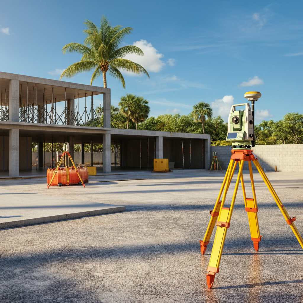
Construction Surveys in Florida
Professional construction surveys tailored for accuracy and success. At Atlantic Coast Surveying, we provide a full range of construction survey services in Florida to support your project at every stage. Using cutting-edge technology and years of expertise, we ensure precise results that meet your specific needs.
Precision You Can Trust in Construction Surveys
When accuracy is critical to your construction project, Atlantic Coast Surveying is your trusted partner. We specialize in delivering precise construction survey services designed to meet the needs of builders, developers, and property owners across Florida. Using advanced surveying technology and over 35 years of expertise, we provide the reliable data you need to ensure your project runs smoothly from start to finish.
Understanding Your Challenges in Construction
Accuracy and compliance are vital in every construction project, but challenges like improper site layouts, regulatory hurdles, or costly errors can cause delays and setbacks. At Atlantic Coast Surveying, we understand the critical role precise data plays in overcoming these obstacles. That’s why our construction surveys are designed to provide the detailed insights you need to move forward with confidence.
Construction Surveys - The Solution
Construction surveys serve as the foundation for successful projects by ensuring accurate site layouts, verifying elevations, and documenting final conditions. Our comprehensive services—including Plot Plan Surveys, Spot Surveys, Final Construction Surveys, As-Built Construction Plans, and State Plane Coordinate mapping—cater to the unique needs of builders, developers, and property owners across Florida. Whether you’re preparing a site, verifying compliance, or analyzing completed work, we deliver the data and expertise to support every phase of your project.
Key Features and Benefits
- Comprehensive Coverage: Advanced surveys tailored to address all aspects of construction, from site layouts to final documentation.
- Trusted Accuracy: Precise results powered by modern surveying technology and a team of seasoned professionals.
- Tailored Expertise: Services designed to meet the needs of contractors, engineers, developers, and property owners.
- Clear Solutions: Avoid costly errors, minimize delays, and ensure compliance with regulatory standards.

Plot Plan Surveys
Atlantic Coast Surveying’s Plot Plan Surveys deliver precise layouts of your construction site, designed to guide your project from the start with accuracy and compliance.
Key inclusions:
- Property Boundaries: Clearly defined lines for accurate site planning.
- Building Placements: Verified locations for proposed structures.
- Site Mapping: Comprehensive mapping of existing and planned features.
- Regulatory Alignment: Ensuring adherence to local requirements.
Using advanced GPS technology and total stations, our expert team provides reliable, tailored data to support initial design decisions and reduce risks of errors. Trust Atlantic Coast Surveying to lay the groundwork for a successful project.
Spot Surveys
Atlantic Coast Surveying’s Spot Surveys ensure your construction elements meet critical elevation standards and align with approved design plans. With our surveys, you can prevent setbacks while staying compliant with local building codes.
Key inclusions:
- Elevation Verification: Confirming slabs, forms, and stem walls meet specified benchmarks.
- Slab Compliance: Ensuring concrete pours align with design requirements.
- Stem Wall Accuracy: Verifying walls are correctly positioned and leveled.
- Actionable Data: Providing reliable measurements for next-step planning.
Using advanced GPS systems and precision surveying tools, our experienced team delivers clear, certified data tailored to your project needs. Trust Atlantic Coast Surveying to keep your build on track and compliant from the ground up.
Final Construction Surveys
Atlantic Coast Surveying delivers Final Construction Surveys to ensure your project concludes with accurate data and adherence to regulatory standards. Using advanced technology like GNSS receivers and total stations, we provide a comprehensive assessment of your completed project.
Key inclusions:
- Boundary Validation: Confirming property lines are accurate and align with legal descriptions.
- Elevation Benchmarks: Ensuring elevation levels meet specified design criteria.
- Building Placement: Verifying structures are positioned as per approved site plans.
- As-Built Topography: Documenting any changes to terrain or site conditions during construction.
Our certified reports are designed for seamless integration with GIS and CAD systems, aiding inspections, record-keeping, and approvals. With Atlantic Coast Surveying, you achieve a reliable, compliant, and well-documented project closeout.
As-Built Construction Plans
Atlantic Coast Surveying’s As-Built Construction Plans capture precise, final site conditions to support compliance and future project planning. These plans are essential for ensuring that constructed elements align with approved designs, providing a dependable reference for owners, contractors, and regulators alike.
Key inclusions:
- Final Site Documentation: Recording actual constructed conditions for reference.
- Compliance Verification: Ensuring projects meet regulatory and design standards.
- Change Records: Documenting deviations from original plans.
- Future Planning Support: Providing a reliable basis for expansions or modifications.
By utilizing cutting-edge technology and innovative surveying techniques, we deliver data that is both accurate and actionable. This precision not only safeguards your immediate construction goals but also lays the groundwork for seamless future improvements and adaptations. Depend on Atlantic Coast Surveying for documentation that protects your investment and ensures long-term success.
State Plane Coordinate Mapping
Atlantic Coast Surveying’s State Plane Coordinate Mapping utilizes advanced GPS technology to deliver accurate spatial data for high-tech and large-scale projects. Our methods ensure that every detail aligns seamlessly with project specifications, enabling confident decision-making and efficient execution.
Key inclusions:
- GPS-Based Mapping: Leveraging GPS systems for precise geographical coordinates.
- Coordinate Accuracy: Delivering detailed Lat/Long and Northing/Easting measurements.
- Regulatory Alignment: Ensuring geodetic compliance with state plane coordinate systems.
- Scalability: Supporting the needs of expansive and technically intricate projects.
Using cutting-edge techniques, we provide dependable data for site planning, infrastructure development, and complex analyses. The integration of advanced technology enhances accuracy and reduces errors, paving the way for successful project outcomes. Trust Atlantic Coast Surveying to deliver the precision mapping essential for your project's success.
Precision in Every Measure
Who Benefits from Construction Surveys
Explore how our construction surveys, including as-built surveys and site layout services, offer reliable solutions tailored to the unique needs of professionals across various industries.
Real Estate Professionals
Facilitate property transactions with accurate site data and detailed documentation that confirm land usability and compliance.
Developers
Plan and execute projects seamlessly with site-specific data that supports proper resource allocation and adherence to design specifications.
Construction Firms
Ensure precise building placement, legal compliance, and cost-efficient progress with comprehensive construction surveys.
Architects and Engineers
Rely on accurate site measurements and layouts to bring plans to life without unexpected challenges or errors during execution.
Government Agencies
Facilitate public infrastructure projects with dependable site data that supports zoning, road construction, and regulatory standards.
Environmental Consultants
Integrate construction survey data to confirm that site preparation and development align with environmental protection guidelines.
Legal Professionals
Utilize precise construction survey records to resolve disputes and validate property compliance with legal requirements.

Precision in Every Step
Construction Surveying Process
At Atlantic Coast Surveying, precision and reliability are the cornerstones of our construction surveying process. Here's an in-depth look at our systematic approach, designed to deliver accurate results that support successful construction projects.
Initial Consultation
We start with a detailed consultation to understand your construction goals and specific project needs. Whether you're working on building placement, grading, or utilities, this step ensures we align our services with your objectives.
Project Assessment
Our surveyors conduct an on-site evaluation to assess the project area, identifying key site features and potential challenges. This thorough assessment provides the foundation for accurate and tailored data collection.
Data Collection
Utilizing state-of-the-art instruments, including GPS and robotic total stations, we collect precise measurements of the land. Every critical detail, from topography to construction layouts, is mapped with accuracy to avoid downstream inconsistencies.
Analysis and Deliverables
After gathering data, our team conducts an in-depth analysis to generate actionable deliverables, such as detailed site plans, grading models, and layout points. These outputs are tailored to streamline construction workflows, ensuring every step aligns with the intended design.
Frequently Asked Questions
Everything You Need to Know About Construction Survey
Discover clear answers to common questions about construction surveys. Learn how they support accurate site planning, ensure compliance, and streamline the construction process. Whether you're coordinating building placement, grading, or utilities, a construction survey provides the reliable data you need to bring your project to life with confidence.
What is a construction survey, and why is it important for my project?
A construction survey ensures your project is built accurately and complies with all design and regulatory standards. At Atlantic Coast Surveying, our services include Plot Plan Surveys for detailed site layouts, Spot Surveys for precise elevation verification, and Final Construction Surveys to document compliance at completion. These services provide the data needed to guide every phase of construction effectively.
What types of services are included in your construction surveys?
Our comprehensive construction surveys address various project needs. These include:
- Plot Plan Surveys – These provide detailed layouts of your construction site, showing property features, building placement, and easements to set a strong foundation for your project.
- Spot Surveys (Forms/Slab/Stem Walls) – Accurately verify the elevation of forms, slabs, and stem walls to ensure they meet design and code requirements.
- Final Construction Surveys – Conducted at the completion of a project, they offer precise measurements to confirm compliance with design plans and provide official documentation for records.
- As-Built Construction Plans – These document the final, as-constructed conditions of a site, capturing any modifications made during construction for future planning and analysis.
- State Plane Coordinate Mapping (GPS/Lat Long/Northing and Easting) – Using advanced GPS technology, this service provides precise geographic coordinates to support large-scale or high-tech projects requiring exceptional accuracy.
Each service is designed to ensure your project is built correctly, efficiently, and in compliance with industry standards.
How does a Plot Plan Survey benefit my construction project?
A Plot Plan Survey delivers a detailed overview of your construction site, including property lines, building placement, and features like easements or utilities. This facilitates proper planning, minimizes risks, and ensures your project adheres to zoning requirements.
What role does a Spot Survey play in construction?
A Spot Survey ensures critical structural components, such as forms, slabs, and stem walls, are placed at the correct elevations. This avoids costly rework and ensures alignment with design specifications and building codes, promoting smooth project progression.
When should I request a Final Construction Survey?
A Final Construction Survey is conducted upon project completion. It provides precise measurements of all constructed elements, ensuring compliance with initial plans and regulations. This survey also serves as an official record for future reference or property transactions.
What is an As-Built Construction Plan, and why is it useful?
An As-Built Construction Plan documents the site’s final conditions after construction is complete. It captures updates or changes made during the building process, offering a reliable reference for maintenance, future projects, or legal documentation.
What is State Plane Coordinate Mapping, and how does it support construction?
State Plane Coordinate Mapping uses advanced GPS technology to map sites with high accuracy, defining location coordinates like latitude, longitude, northing, and easting. This service is invaluable for high-tech or large-scale projects requiring precise measurements.
How can construction surveys help minimize project delays?
By addressing critical aspects like site layouts, elevations, and utility mapping early, our construction surveys help identify potential conflicts or issues before they escalate. Accurate data and documentation reduce the risk of errors, rework, or compliance delays.
How do you ensure your construction surveys are compliant with regulations?
All our services, including Spot Surveys, Final Construction Surveys, and State Plane Coordinate Mapping, are performed to meet local, state, and federal regulations. Our detailed reports provide the necessary documentation to satisfy permitting and inspection requirements.
Why should I choose Atlantic Coast Surveying for my construction survey needs?
Atlantic Coast Surveying offers precision-driven services, advanced technology, and years of expertise. From Plot Plan Surveys to Final Construction Surveys, each of our services is tailored to support your project’s success. With a focus on accuracy and reliability, we provide the critical data you need to move forward with confidence.
Your Trusted Surveying Partner
Why Work with Atlantic Coast Surveying?
When you choose Atlantic Coast Surveying, you’re partnering with a team committed to delivering excellence. Here’s what sets us apart:
Licensed and Insured Professionals
Our skilled surveyors bring unmatched expertise and meticulous attention to detail, ensuring every project is completed to the highest standards.
Advanced Technology for Superior Accuracy
Leveraging state-of-the-art tools like GPS systems and 3D scanning, we provide precise and efficient surveying solutions tailored to your project's needs.
Customer-First Approach
Your satisfaction is our priority. From the initial consultation to project delivery, we provide clear communication and real-time updates, ensuring you’re informed every step of the way.
Seamless and Transparent Service
Enjoy a stress-free experience with transparent pricing, personalized timelines, and the ability to review draft surveys before final delivery. We’re here to make your project a success.