Boundary Surveys in Florida
Expert boundary surveys designed for precision and clarity. At Atlantic Coast Surveying, we offer comprehensive boundary survey services in Florida, including topographic and tree surveys. With advanced technology and decades of expertise, we deliver accurate results tailored to your property and project requirements.
Precision You Can Trust in Boundary Surveys
When you need accurate boundary surveys in Florida, Atlantic Coast Surveying is your trusted partner. We specialize in delivering precise boundary survey services, including topographic and tree surveys, to meet your property and project requirements. With over 35 years of experience and advanced surveying technology, we provide detailed, reliable, and timely results. Whether you’re planning a development or need clarity on property boundaries, rely on us for the data you need to make informed decisions with confidence.
Understanding Your Challenges
Property boundaries are a critical aspect of any transaction, but uncertainties about boundary lines, encroachments, or easements can lead to costly disputes, delays, or legal complications. At Atlantic Coast Surveying, we know just how important it is to eliminate these challenges. That’s why our boundary surveys, including topographic and tree surveys, provide the precise data you need to move forward with confidence on any property-related project.
Boundary Surveys - The Solution
Boundary surveys are essential for establishing property lines, identifying legal boundary details, and uncovering any encroachments or easements. Our comprehensive surveys, which include topographic and tree surveys, are
designed to meet the needs of property owners, developers, and legal professionals across Florida. Whether you’re planning to develop a site, purchase land, or clarify property lines, Atlantic Coast Surveying ensures accuracy, transparency, and peace of mind throughout the process.
Key Features and Benefits
- Comprehensive Service: Detailed analysis of property boundaries, easements, encroachments, and land features such as trees and topography.
- Trusted Accuracy: Reliable results backed by advanced surveying technology and experienced professionals.
- Tailored Expertise: Ideal for homeowners, developers, landowners, and legal teams needing exact boundary information.
- Clear Solutions: Avoid disputes and minimize delays in property transactions or development projects.
Topographic Surveys
At Atlantic Coast Surveying, our Topographic Surveys offer a precise representation of your land’s elevation, contours, and features. Using advanced tools and expert methodology, we map both natural and man-made elements to support a wide range of planning and development projects.
Our Topographic Surveys include:
- Elevation Mapping: Capturing detailed contours and slopes to guide land leveling and grading efforts.
- Feature Documentation: Mapping key natural and constructed features such as drainage patterns, buildings, roads, and utilities.
- Advanced Technology Integration: Leveraging GPS, total stations, and laser scanning for exceptional accuracy and efficiency.
- Regulatory Compliance Support: Providing the data required to meet zoning and permitting standards.
These surveys are vital for informed decision-making in construction and land development, ensuring projects are designed with precision and efficiency. Trust Atlantic Coast Surveying to deliver reliable, comprehensive topographic surveys tailored to your project’s unique needs.
Tree Surveys
At Atlantic Coast Surveying, our Tree Surveys provide detailed documentation of the trees on your property. Using expert assessment methods, we identify and evaluate each tree to support environmentally compliant and well-informed development decisions.
Our Tree Surveys include:
- Tree Location Mapping: Accurately identifying and recording the position of trees across your property.
- Species Identification: Providing precise details on tree species for ecological and regulatory purposes.
- Size and Health Assessment: Measuring characteristics such as height, trunk diameter, and canopy spread while evaluating overall health.
- Regulatory Compliance Support: Ensuring adherence to local ordinances and environmental regulations to minimize development impact.
These surveys are essential for balancing project goals with ecological considerations, helping you create responsible landscaping plans that protect existing vegetation. Trust Atlantic Coast Surveying to deliver thorough, reliable data to guide your development efforts.
Precision in Every Measure
Who Benefits from Boundary Surveys?
Discover how our boundary surveys, including topographic and tree surveys, provide reliable solutions designed to meet the diverse needs of professionals across multiple industries.
Real Estate Professionals
Streamline property transactions with verified boundary data and clear documentation.
Property Buyers and Sellers
Gain a thorough understanding of property boundaries before closing any deal, reducing risks and surprises.
Developers
Plan and execute projects confidently with precise boundary details that help avoid costly setbacks.
Construction Firms
Ensure compliance and accurate building placement with detailed boundary insights.
Government Agencies
Support accurate public planning and projects with dependable land boundary information.
Insurance Companies
Evaluate land risks and conditions accurately to provide tailored coverage decisions.
Environmental Consultants
Verify property limits and land features to ensure adherence to environmental regulations.
Legal Professionals
Depend on precise boundary surveys to support property-related disputes and legal proceedings.

Precision in Every Step
Boundary Survey Process
At Atlantic Coast Surveying, precision and transparency guide every aspect of our boundary surveys. Here's a comprehensive look at how we deliver accurate results, tailored to meet your specific property documentation needs.
Initial Consultation
We start with a one-on-one consultation to understand your unique goals. Whether you're a homeowner, developer, or attorney, this step allows us to tailor our boundary survey services, including options for topographic surveys and tree surveys, to your exact requirements.
Records Research
Our team conducts a thorough search of legal and historical property records. This includes deeds, plats, and prior surveys to establish a clear foundation for defining accurate boundary lines.
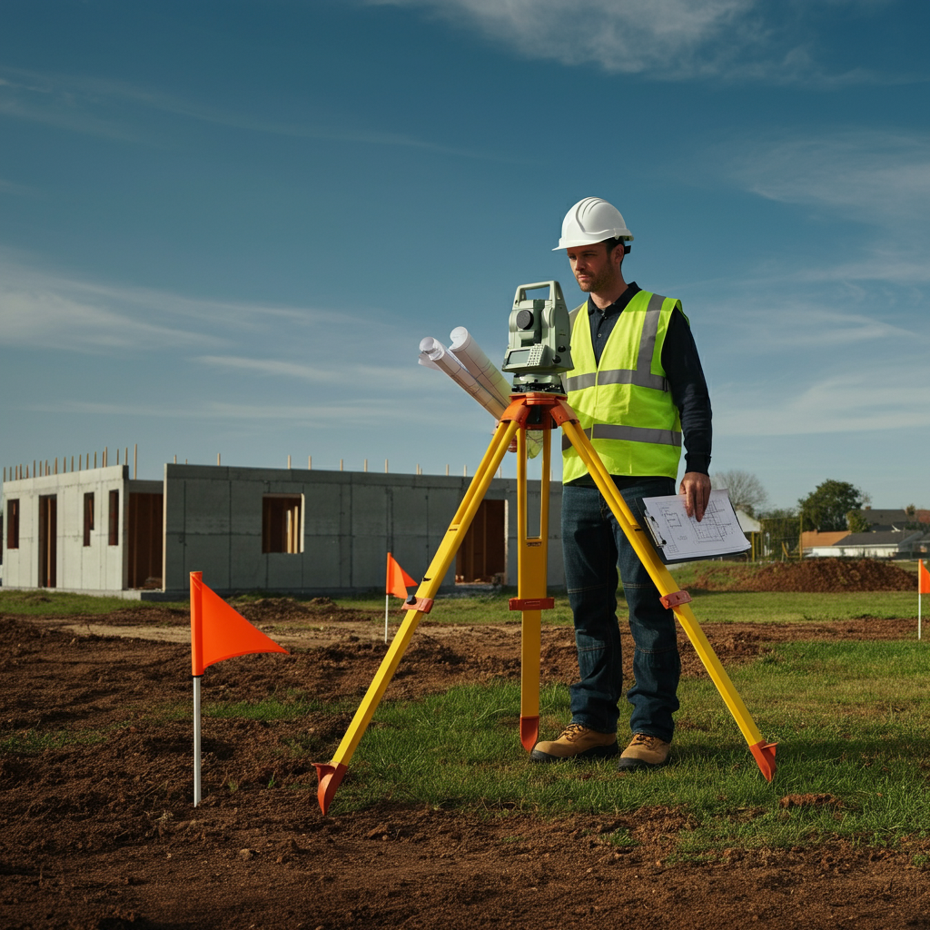
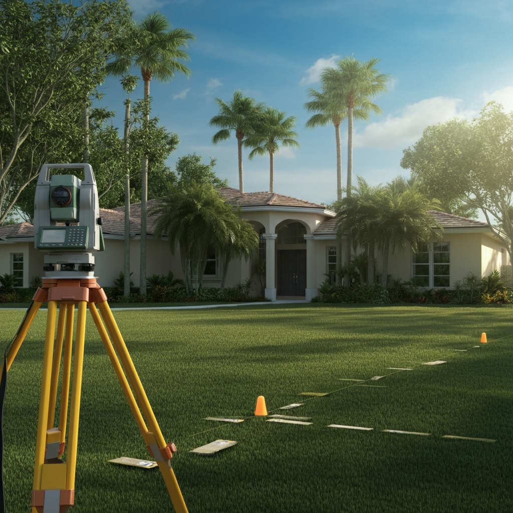
Field Survey
Using advanced equipment such as GPS systems and total stations, our surveyors visit the site to identify boundary markers, easements, and other crucial property features. If needed, we also perform topographic surveys and tree surveys to provide a detailed understanding of the land's features.
Data Analysis and Calculations
The data collected in the field is meticulously reviewed and analyzed. Our surveyors calculate exact boundary lines, ensuring every detail aligns with legal requirements and your project’s needs.
Plat Preparation
We create a detailed plat that represents your property’s boundaries, easements, and any notable features identified during the survey. This document serves as your key reference for property ownership and development planning.
Monumentation (if needed)
Where applicable, we install permanent markers to demarcate your property’s boundaries, ensuring they are clearly identified for future reference.
Delivery and Explanation
The final survey results, including plats and supporting documentation, are delivered to you promptly. Our team walks you through the results, answering any questions and ensuring you fully understand the boundaries of your property.
Benefits of a Boundary Survey
With Atlantic Coast Surveying, you gain clarity on your property lines, prevent potential disputes, and ensure compliance with zoning and legal requirements. Our precision-focused approach, including the integration of topographic and tree surveys, equips you with the data you need to make confident decisions for any project or transaction.
Frequently Asked Questions
Everything You Need to Know About Boundary Surveys
Get clear answers to common questions about boundary surveys. Understand how they define property lines, why they’re essential, and the numerous ways they support property transactions, development projects, and landownership clarity. Whether you're resolving disputes, planning construction, or ensuring compliance, a boundary survey provides the precision you need to move forward with confidence.
What is a boundary survey?
A boundary survey determines the precise legal boundaries of a property. At Atlantic Coast Surveying, we use advanced equipment and detailed research to define your property's exact dimensions, ensuring complete clarity for ownership and use. Choosing us means working with experts who understand the complexities of boundary determinations, so you can trust your survey is accurate and comprehensive.
Why should I get a boundary survey?
Boundary surveys are essential for property transactions, new construction, or resolving disputes. They safeguard your investment by preventing boundary conflicts and ensuring compliance with regulations. With Atlantic Coast Surveying, you gain reliable results that are tailored to your specific needs, giving you the confidence to move forward with your plans.
What’s included in a boundary survey?
Our boundary surveys cover precise property measurements, clear identification of boundary lines, easements, and encroachments. If needed, we provide additional services like topographic surveys to map land elevation and features, or tree surveys to identify and document significant vegetation on your property. These added elements provide a deeper understanding of your land, especially for development purposes.
How much does a boundary survey cost?
Get QuoteThe cost depends on multiple factors, including the size and location of your property, terrain complexity, and available documentation. At Atlantic Coast Surveying, we offer competitive, transparent pricing tailored to your needs. Contact us directly for an accurate and customized quote—we're here to help!
How long does a boundary survey take?
A typical boundary survey timeline depends on the property’s size, complexity, and any additional services required, like topographic or tree surveys. Most surveys are completed within a few days to a few weeks. During your initial consultation, we’ll provide a more specific timeframe and keep you updated throughout the process.
What are topographic and tree surveys, and why might I need them?
Topographic surveys map the elevation and contours of your land, along with key features like slopes, structures, and drainage patterns. They’re invaluable for planning construction projects or evaluating land-use potential.Tree surveys document the location, size, and type of trees on your property. These surveys are often required for environmental compliance or landscaping plans.
What makes Atlantic Coast Surveying the right choice for my project?
We combine state-of-the-art equipment with decades of experience to deliver surveys that are accurate, reliable, and tailored to your needs. Our team is licensed, highly skilled, and familiar with all state and local regulations. Plus, we offer specialized services like topographic and tree surveys to add exceptional value. When you choose us, you’re choosing a partner focused on your success and satisfaction.
What happens during the boundary survey process?
At Atlantic Coast Surveying, we take pride in making the boundary survey process as seamless and precise as possible for our clients. Here’s what you can expect when you work with us:
- Initial Research: We start by diving into the history of your property. This includes reviewing deeds, plats, and any previous surveys to gather all the necessary information about your land.
- On-Site Fieldwork: Our team visits your property equipped with state-of-the-art tools like total stations and GPS systems. We locate existing boundary markers, fences, and other physical features to ensure accuracy.
- Boundary Marker Verification: If boundary markers are missing or unclear, we’ll identify their original locations and, if needed, place new markers to clearly define your property lines.
- Data Analysis and Resolution: We meticulously compare our field measurements with historical records to resolve any discrepancies and ensure your boundaries are legally accurate.
- Detailed Survey Map: Once the boundaries are confirmed, we create a comprehensive survey map that outlines your property lines, dimensions, and any notable features like easements or encroachments.
- Final Report and Delivery: We’ll provide you with a signed and sealed survey map along with a detailed report. Our team is always available to walk you through the findings and answer any questions.
At Atlantic Coast Surveying, we understand how important it is to get your boundaries right. Whether you’re buying, building, or resolving a boundary issue, our licensed and experienced surveyors are here to help.
Will a boundary survey prevent disputes with neighbors?
Yes! A boundary survey establishes clear, legal property lines, minimizing the risk of disputes. If you’re already dealing with conflicting claims, our detailed documentation and expertise can provide the evidence needed to resolve the issue amicably or legally. Hiring Atlantic Coast Surveying means you’ll have an accurate survey you can trust.
Can Atlantic Coast Surveying help with zoning and legal requirements?
Absolutely! Our surveys meet all legal and zoning standards, giving you the confidence to proceed with transactions or developments. With our expertise in boundary, topographic, and tree surveys, we provide all the data you need to ensure compliance with local regulations and make informed decisions without delays or complications.
Your Trusted Surveying Partner
Why Work with Atlantic Coast Surveying?
When you choose Atlantic Coast Surveying, you’re partnering with a team committed to delivering excellence. Here’s what sets us apart:
Licensed and Insured Professionals
Our skilled surveyors bring unmatched expertise and meticulous attention to detail, ensuring every project is completed to the highest standards.
Advanced Technology for Superior Accuracy
Leveraging state-of-the-art tools like GPS systems and 3D scanning, we provide precise and efficient surveying solutions tailored to your project's needs.
Customer-First Approach
Your satisfaction is our priority. From the initial consultation to project delivery, we provide clear communication and real-time updates, ensuring you’re informed every step of the way.
Seamless and Transparent Service
Enjoy a stress-free experience with transparent pricing, personalized timelines, and the ability to review draft surveys before final delivery. We’re here to make your project a success.