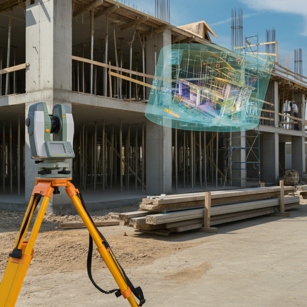
3D Scanning Services in Florida
Cutting-edge 3D scanning solutions tailored to your needs. At Atlantic Coast Surveying, we leverage advanced technology and years of expertise to provide precise, high-resolution data for every project. Whether capturing intricate details of structures, mapping complex environments, or enhancing project planning, our 3D scanning services deliver unbeatable accuracy and actionable insights.
Precision You Can Trust in 3D Scanning Services
When you need reliable 3D scanning services in Florida, Atlantic Coast Surveying is your trusted partner. Our experienced team delivers high-precision 3D scans tailored to your project requirements. With over 35 years of expertise and cutting-edge technology, we provide detailed, accurate data to support a wide range of industries, from construction and engineering to historical preservation and industrial design
Understanding Your Challenges
Capturing precise details in complex environments can be challenging without the right tools. Unclear data on measurements, structures, or spatial relationships can lead to costly design errors, delays, or safety concerns. We understand that overcoming these challenges is critical, which is why our 3D scanning services eliminate uncertainty, delivering transparency and accuracy for every project.
3D Scanning - The Solution
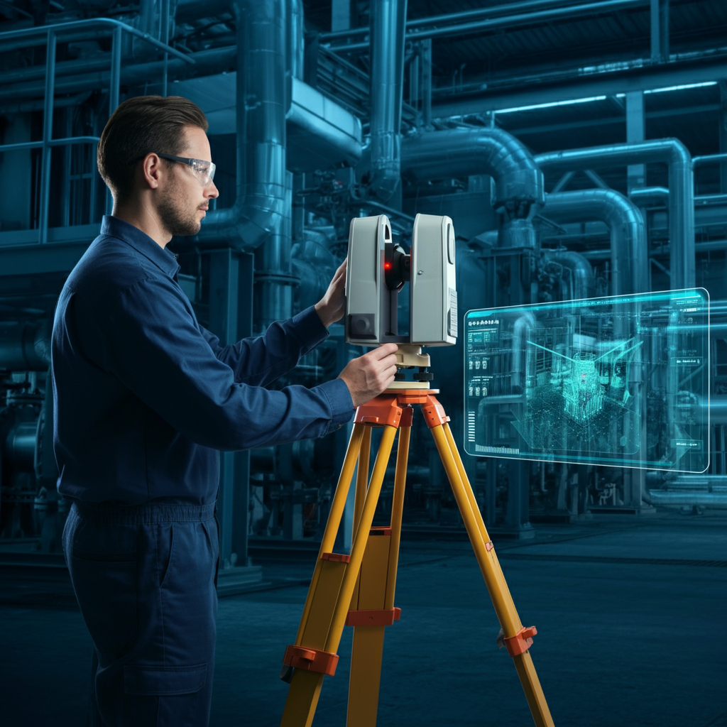
3D scanning provides accurate and high-resolution data that transforms how industries visualize and plan projects. Using advanced laser scanning and imaging technology, this method captures detailed, real-world data in a fraction of the time traditional methods require. Whether you’re working in construction, engineering, or industrial design, Atlantic Coast Surveying ensures you have the precise insights needed to proceed with confidence.
Key Features and Benefits
- Comprehensive Data Capture: Highly detailed scans that accurately represent structural and spatial environments.
- Guaranteed Precision: Advanced technology ensures reliable results for the most complex projects.
- Versatile Applications: Ideal for construction, manufacturing, historical preservation, and more.
- Efficiency: Reduces time spent on measurements and minimizes on-site disruptions.
- State-of-the-Art Technology: Utilizes cutting-edge 3D laser and imaging systems to produce precision-driven results.
Precision in Every Measure
Who Benefits from 3D Scanning Services?
Discover how our 3D scanning solutions deliver unmatched accuracy and actionable insights tailored to meet the diverse needs of professionals across various industries.
Real Estate Professionals
Streamline property assessments with precise 3D models, helping you visualize structures and plan developments confidently.
Construction Companies
Ensure accurate measurements and detailed site data to prevent costly errors during planning and building phases.
Architects and Designers
Create detailed digital replicas of spaces to enhance architectural precision and support innovative designs.
Manufacturing & Industrial Facilities
Optimize operations with high-accuracy 3D scans of machinery, layouts, and production lines for streamlined upgrades and maintenance.
Historical Preservation Experts
Capture the intricate details of heritage sites with unparalleled accuracy to aid preservation and restoration efforts.
Oil and Gas Professionals
Map complex pipelines and facilities with precision, ensuring safety and efficiency in challenging environments.
Utility and Infrastructure Managers
Obtain detailed spatial data to support maintenance, inspections, and new installations of critical infrastructure.
Environmental Consultants
Analyze terrain and ecosystems with precise 3D measurements to ensure compliance and support sustainable planning.
Precision in Every Step
3D Scanning Process
At Atlantic Coast Surveying, precision and innovation define our approach to 3D Scanning services. Here’s an in-depth look at our streamlined process, designed to deliver accurate and actionable insights for your project needs.
Initial Consultation
We begin with a detailed discussion to understand your unique project requirements, whether you’re in construction, design, or industrial operations. This step ensures our solutions are customized to align perfectly with your goals.
Site Assessment
Our team conducts a thorough site evaluation to identify key areas for scanning and prepare for effective data capture. This step ensures we take every variable into account before starting the process.
Data Collection
Using state-of-the-art 3D laser scanners and imaging technology, we capture highly detailed, precise measurements of your environment. From structures to complex machinery, every dimension is recorded with accuracy.
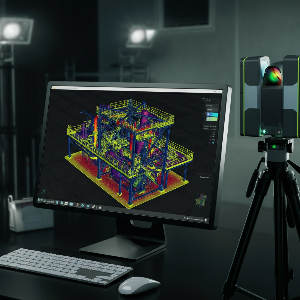
Analysis and Reporting
Following data collection, we process and analyze the scans, creating detailed 3D models and comprehensive reports. These deliverables provide the clarity needed for informed decision-making and seamless project execution.
Frequently Asked Questions
Everything You Need to Know About 3D Scanning
Get clear answers to common questions about 3D Scanning services. Learn how this advanced technology works, why it’s essential, and how it benefits diverse projects and industries.
What is 3D scanning, and how does it work?
3D scanning is a process that captures the exact shape, size, and details of an object or environment using advanced laser and imaging technology. The scanner emits lasers or light to measure the geometry of a surface, creating an accurate digital model that can be used for design, analysis, or documentation.
What are the key benefits of 3D scanning?
3D scanning provides unmatched accuracy, saves time during the documentation process, and reduces errors in project planning. It allows for precise data capture, supports innovative designs, improves efficiency in inspections, and helps streamline operations across various industries.
What industries use 3D scanning?
3D scanning is widely used in industries such as construction, real estate, architecture, manufacturing, historical preservation, oil and gas, infrastructure planning, and environmental consulting. It supports a wide range of applications, from creating digital twins to mapping complex environments.
How accurate is 3D scanning?
The accuracy of 3D scanning depends on the technology and equipment used. At Atlantic Coast Surveying, our scanners provide sub-millimeter precision, ensuring highly detailed and reliable digital representations of structures and environments.
Can 3D scanning be used for historical preservation?
Yes, 3D scanning is an essential tool for historical preservation. It captures intricate details of monuments, sculptures, and historical buildings with extreme accuracy. This non-intrusive method helps document heritage sites digitally and aids in restoration and preservation projects.
How does 3D scanning improve construction projects?
3D scanning enhances construction projects by providing detailed site data for planning, monitoring progress, and verifying work against the original design. It minimizes errors, reduces costs, and ensures compliance with safety standards.
Is 3D scanning useful for creating as-built models?
Absolutely. 3D scanning is perfect for creating accurate as-built models. By capturing precise measurements of existing structures, it enables architects, engineers, and builders to understand the current layout and conditions, ensuring seamless renovations or modifications.
What materials or objects can be scanned with 3D scanning?
3D scanning can be used on a wide variety of objects and materials, including buildings, machinery, artwork, terrain, and even small components. The technology is versatile and can handle complex geometries, irregular textures, and varying material types.
How long does it take to complete a 3D scanning project?
The duration varies based on the size and complexity of the project. Smaller projects can take a few hours, while larger-scale scans, such as industrial sites or historical buildings, may take days. At Atlantic Coast Surveying, we prioritize efficiency without compromising accuracy.
How can I use the data from a 3D scanning project?
Contact UsData from 3D scanning can be used for creating CAD models, performing quality inspections, designing renovations, planning construction, mapping environments, and more. The precise digital models and reports provide invaluable insights for informed decision-making and project execution.
For more information about our 3D scanning services, contact us today! We're here to help.
Your Trusted Surveying Partner
Why Work with Atlantic Coast Surveying?
When you choose Atlantic Coast Surveying, you’re partnering with a team committed to delivering excellence. Here’s what sets us apart:
Licensed and Insured Professionals
Our skilled surveyors bring unmatched expertise and meticulous attention to detail, ensuring every project is completed to the highest standards.
Advanced Technology for Superior Accuracy
Leveraging state-of-the-art tools like GPS systems and 3D scanning, we provide precise and efficient surveying solutions tailored to your project's needs.
Customer-First Approach
Your satisfaction is our priority. From the initial consultation to project delivery, we provide clear communication and real-time updates, ensuring you’re informed every step of the way.
Seamless and Transparent Service
Enjoy a stress-free experience with transparent pricing, personalized timelines, and the ability to review draft surveys before final delivery. We’re here to make your project a success.